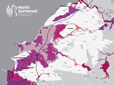
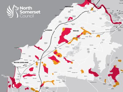
With the second-highest tidal range in the world, the tide along the North Somerset coast rises quickly and the current can be strong.
During high tides, we carefully monitor the following things. These are important tools to indicate whether flooding is likely to happen:
- tide heights
- wind speed
- wind direction
- wave buoy data
- weather and flood forecasts
We rely on Environment Agency warnings along with our own observations. If there is an increased risk of flooding from the sea, we will make a decision to deploy the sea defence gates in Weston-super-Mare. If we do this, we also tell residents and businesses along our seafronts.
Clevedon
If there is an increased risk of flooding from the sea, we may close The Beach in Clevedon.
Residents should be aware that high tides and strong winds may throw debris into the road.
We are currently investing in restoring the Victorian sea walls to improve their strength. To find out more, read this article from our September 2023 edition of Life email newsletter.
Portishead
We may close Esplanade Road in Portishead if there is increased risk of flooding from the sea.
Residents should be aware that high tides and strong winds may throw debris into the road.
Weston-super-Mare
There are flood defence walls, including 12 tide gates, along the promenade in Weston-super-Mare. These give extra protection for homes and businesses in the town. We may close the gates in various combinations depending on the level of risk expected.
We are currently investing in restoring the Victorian sea wall near Anchor Head to improve its strength. To find out more, read this article from our September 2023 edition of Life email newsletter.
The sand dunes at either end of Weston-super-Mare - at Uphill and Sand Bay - also form an important part of the natural sea defences for the surrounding area.
We are currently trialling fenced off areas of the dunes to encourage vegetation to grow and strengthen the dunes. To find out more, read our news release from June 2023.


